|
SEE ALSO:
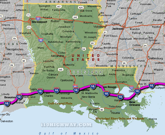
i-10 Louisiana Traffic map.
The i-10 travels across Louisiana in generally a east - west direction
... to the east; the i-10 travels into the state of
Mississippi,
and to the west; the i-10
travels into the state of Texas.
The total distance of the i-10 across the state of Louisiana is approx. 274
miles long, which requires an approx. driving time of 4 hours and 34 minutes to complete when driving an average speed of 60 miles
per hour.
See also: Regional i-10 Louisiana traffic maps;
Baton Rouge,
Breaux Bridge,
Crowley,
Eden Isle,
Henderson,
Iowa,
Jennings,
Kenner,
Lafayette,
Lake Charles,
LaPlace,
Metairie,
New Orleans,
Port Allen,
Rayne,
Slidell,
Sorrento,
Sulphur,
Vinton,
Welsh, and
Westlake.
|