|
SEE ALSO:
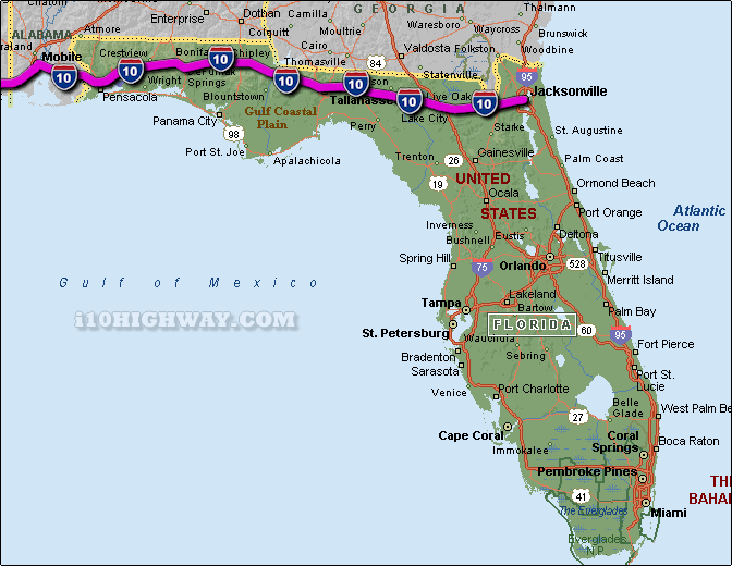
i-10 Florida Traffic.
The i-10 travels across Florida in generally a east - west direction
... at it's eastern most point, the i-10 begins/ends on the east coast of
Florida in the city of Jacksonville near the Atlantic Ocean ... travelling west on the i-10 across
Florida; the i-10 travels into the state of Alabama.
The total distance of the i-10 across the state of Florida is approx. 362
miles long, which requires an approx. driving time of 6 hours and 2 minutes to complete when driving an average speed of 60 miles
per hour.
See also: Regional i-10 Florida traffic maps;
Bagdad,
Baldwin,
Bonifay,
Brent
Chipley,
Crestview,
DeFuniak Springs,
Ensley,
Escambia Bay Bridge,
Glen St. Mary,
Greensboro,
Greenville,
Jacksonville,
Lake City,
Live Oak,
Lloyd,
Macclenny,
Madison,
Marianna,
Midway,
Mossy Head,
Pensacola,
Ponce de Leon,
Quincy, and
Tallahassee.
See also: i-75 Florida and
i-95 Florida. |